
Altavista Petroglyphs: How to Visit Nayarit's Sacred Site
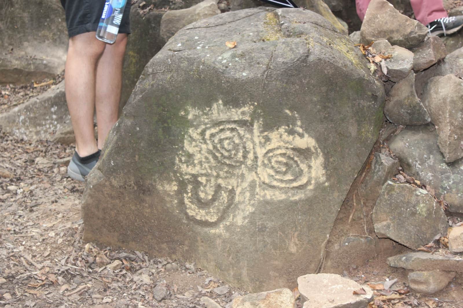
The Altavista petroglyphs sit in a creek canyon in the hills above the Nayarit coast, where boulder after boulder carries spirals, crosses, and human figures cut into volcanic rock. Fifty-six carvings are catalogued in the section open to visitors, and archaeologists have registered more than two thousand across the wider complex. The site answers to several names: Altavista, La Pila del Rey, Chacalan, El Santuario. It is not a ruin and it is not a museum. Wixarika (Huichol) families still walk in to leave offerings and hold ceremonies here, and that one fact should shape everything about how you visit.
Perfect if: you like rocky trails, old stone, and places that are still in use.
Skip it if: you want paved access, a flat path, or a gift shop at the end.
Table of Contents
- What the Altavista petroglyphs actually are
- Where the site is and how to get there
- The entrance and the walk
- La Pila del Rey and the pools
- Visiting a living ceremonial site
- Best time to visit
- What to bring
- Staying a few minutes from the site turnoff
- Frequently asked questions
- What are the Altavista petroglyphs?
- How much does it cost to visit the Altavista petroglyphs?
- Do you need a 4x4 to reach the Altavista petroglyphs?
- How long is the hike to the petroglyphs?
- Is the site ever closed?
- Can you swim at La Pila del Rey?
- Do you need a guide?
- Related reads
What the Altavista petroglyphs actually are
They are rock carvings made by the Tecoxquin people, scattered along the Las Piletas creek across roughly 80 hectares of hillside. Fifty-six are catalogued in the visitor section, which is the number you will see quoted everywhere, but researchers have registered more than two thousand across the full complex. That makes it one of the largest known concentrations of rock carvings anywhere.
The age is less settled than most guides admit. Sources agree the carvings are at least two thousand years old, and several push the Tecoxquin presence in this valley much further back. The reference record for the Altavista petroglyph complex is honest about it: the exact antiquity cannot be determined. What is not in doubt is what the carvings were for. They are read as petitions, for rain, for crops, for health and fertility, which is also why the site never stopped being sacred. Mexico News Daily's visit to the site is the best long read on it if you want more before you go.
Where the site is and how to get there
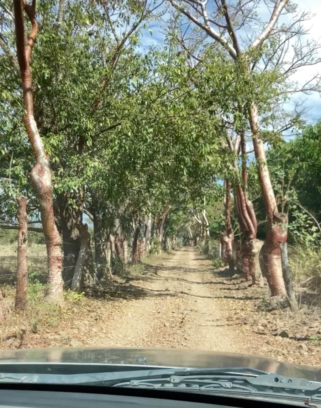
The highway turnoff is on Highway 200 between kilometer 81 and 82, roughly ten kilometers north of La Penita and south of Las Varas. The sign says Altavista, 7 km. Take it, drive under the pista, and keep going. About 1.6 kilometers in, the site turnoff is on your left and the asphalt ends. Stay straight instead and you are in the town of Altavista about eight minutes later.
From the site turnoff, follow the road down for a few minutes, take a right, and stay on it as it curves, crosses a dry riverbed, and runs past the maracuya orchard. It ends at the parking area, which is free. Plan on 15 to 20 minutes for that stretch, longer if your vehicle has to crawl over the rock and boulders.
That stretch is the part people underestimate. Dirt, loose rock, boulders, ruts, and a riverbed crossing. It is the reason a 4x4 or high clearance vehicle matters here. In a regular car, park where the road starts to get dicey and walk the rest. Plenty of people do, so give yourself the extra time. If you are deciding whether to pick up a car at all for your trip, our notes on renting a car in Nayarit cover what actually matters on these back roads.
Plenty of visitors say the same thing: the way in is hard to work out the first time. If you are staying with us and just want a lift, we do that. If you want the history told properly by someone who speaks English, book a guided visit through Nayarit Uncovered.
The entrance and the walk
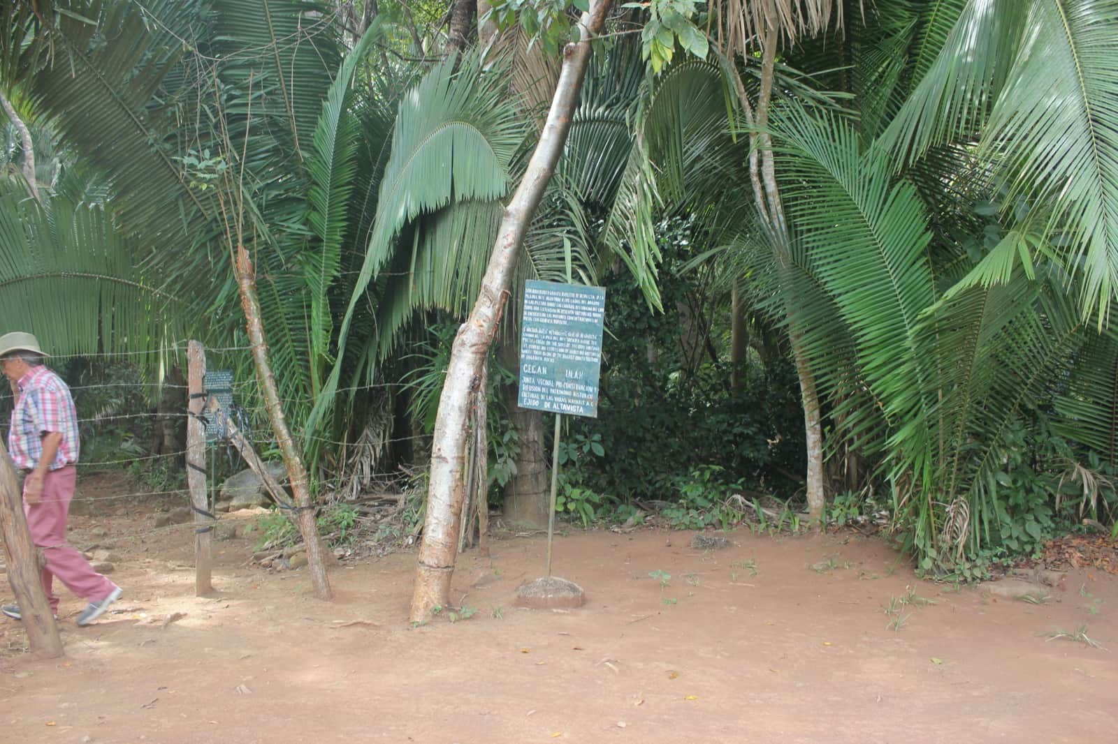
Parking is free. The fee is collected at the entrance, a wire fence and a blue INAH sign at the edge of the jungle, where a caretaker sits and the walk begins. It is a small cash amount, usually somewhere between 20 and 50 pesos per person. It changes, so bring extra in coins and small bills and do not count on anyone having change. That money is not a ticket price. The caretaker is local family and the fee is what keeps the site maintained and cleaned.
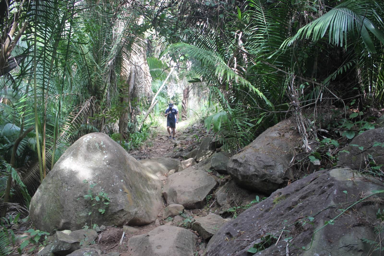
From the entrance the walk runs roughly 25 to 45 minutes each way, longer if you had to park early and walk the road in. It follows the creek over rock shelves, it is uneven the whole way, and it is shaded for most of its length, which is the mercy of this hike. Add the time you will spend standing still in front of carvings. Along the path there are fifteen interpretive signs in Spanish and English explaining what you are looking at, which is more than most sites on this coast offer.
This is not a walk for anyone with mobility trouble. It is a real trail over real rock, not a groomed path.
La Pila del Rey and the pools
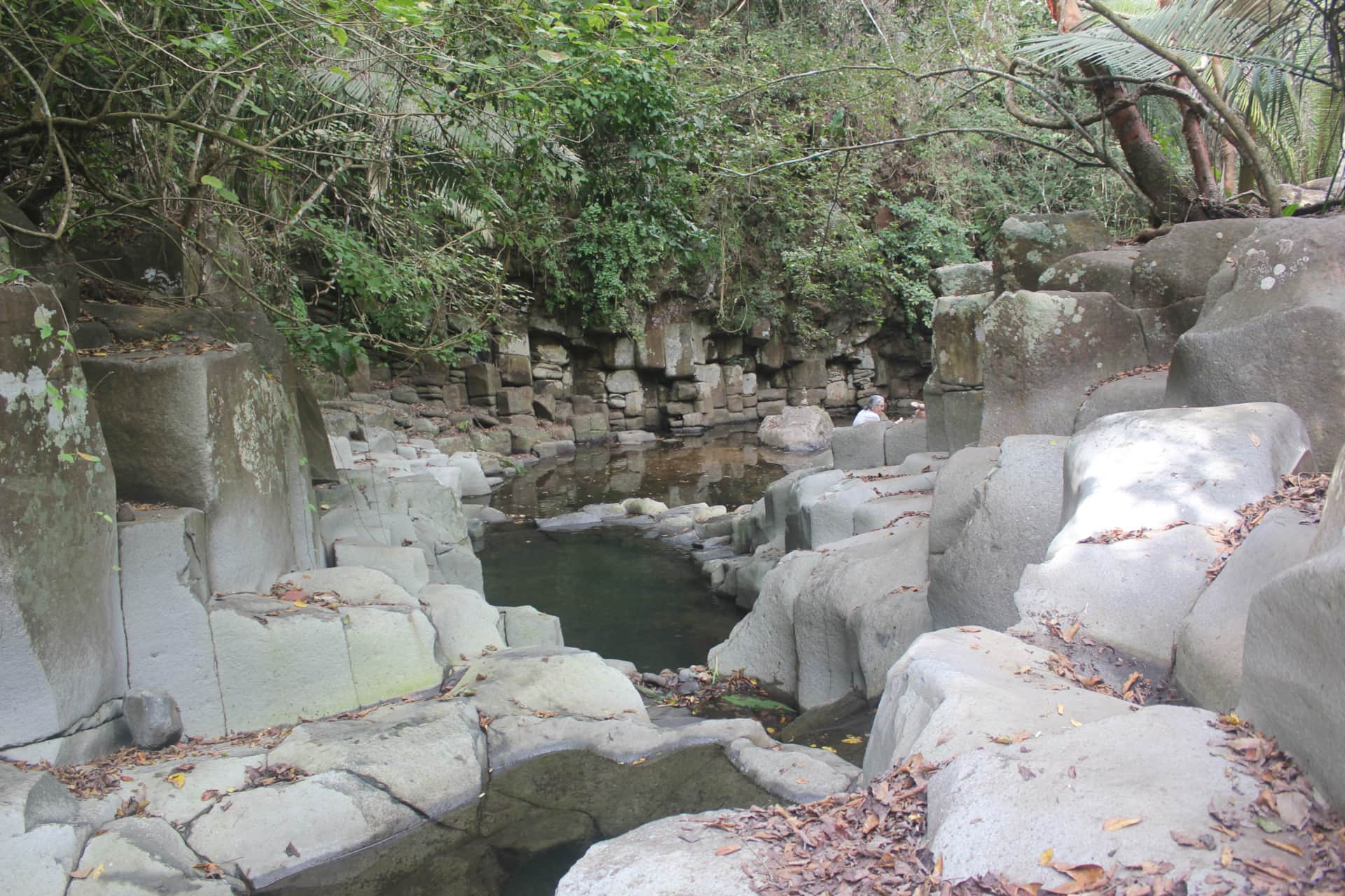
La Pila del Rey is the stone basin at the far end of the walk, spring fed and cold enough to make you gasp, ringed by columnar basalt. The spring keeps water in it, which is why it holds up better through the dry months than people expect.
The rest of the creek is a different story. The small waterfalls and the string of pools along the way run on rain, so after a wet season they are full and in the deep dry months they can be down to trickles and puddles. You can swim, so bring a towel. Either version of the creek is worth the walk.
Visiting a living ceremonial site
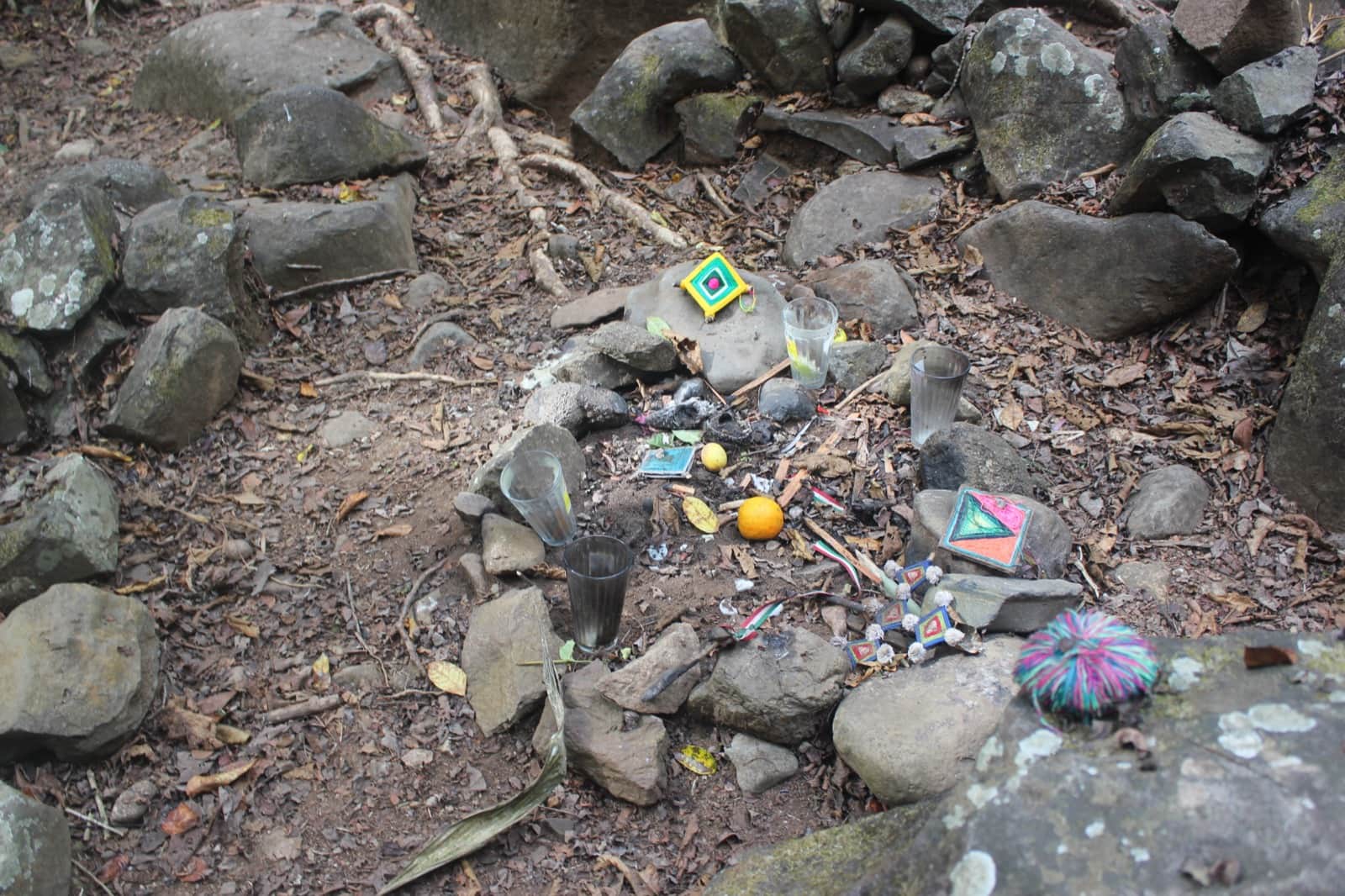
Altavista is an active Wixarika ceremonial site, and this is the part that matters most. You will very likely see offerings along the way: coins, candles, ribbons, arrows, small bundles tucked into rock. They are not decoration and they are not souvenirs. Leave them exactly where they are.
The site also closes sometimes, with no notice at all, because a ceremony is happening. Nobody publishes a schedule and nobody announces it. If you drive all the way out and find it closed, that is the site doing exactly what it has always done. Go back another morning.
The local etiquette is simple and it is posted. Bring water, but leave food outside the entrance. Do not touch the carvings or the offerings. Come in quietly and keep your voices down. If a ceremony is underway, give it the whole clearing and wait or turn back. The people who carved these stones have descendants, they are still here, and this is still their place.
Best time to visit
Dry season, roughly November through May, is the easy window: the road in is at its most forgiving and the canyon is comfortable. Rainy season, June through October, turns that road into the hardest part of the day, and the creek runs at full volume, so it is the better looking visit and the harder drive. Pick your trade.
Time of day matters more than month. Go first thing. The heat and humidity climb fast in that valley, the light is better early, and you will likely have the canyon to yourself.
What to bring
Small bills for the entrance, water, a towel if you plan to get in, shoes you can rock hop in, a hat, sunscreen, and bug spray. Food stays outside the entrance. Watch your footing on the rock and keep an eye on where you put your hands.
Staying a few minutes from the site turnoff
Most people drive in from a beach town, do the walk, and drive back out in the heat of the day. Staying in the town of Altavista skips all of that. Cerrito Encantado is our place on the hill here, just below the town's main road, and we are part time on the property. The site turnoff is about eight minutes back down the road you came in on, then the 15 to 20 minutes of dirt to the parking area, which means you can be at the entrance in the first good light instead of at eleven in the morning with everyone else.
There is a petroglyph right here in town too, near the sports court, and if we are around when you visit we are happy to walk you over and show you.
The rest of the coast is still right there when you want it: La Penita is 20 minutes, Rincon de Guayabitos about 25, Los Ayala about 30, and Chacala beach 25 to 30. Come back to a salt water pool, Starlink that actually holds a video call, and a town that gets on with its own noisy life around you. Roosters, church bells, somebody's music. That is not a defect, that is the town.
Guests who would rather not drive the road at all can book our ride and wait: we take you to the site and give you up to two hours there, 7,000 pesos for up to three people. Ask when you book.
Bringing a group? The whole property books as one on our groups and retreats page.
For the annual festival and everything else in town, see our Altavista town guide.
Frequently asked questions
What are the Altavista petroglyphs?
They are ancient rock carvings along the Las Piletas creek in the hills of Nayarit, made by the Tecoxquin people at least two thousand years ago. Fifty-six are catalogued in the area open to visitors and more than two thousand have been registered across the wider complex. The site is still used for ceremonies by Wixarika (Huichol) people today.
How much does it cost to visit the Altavista petroglyphs?
Parking is free. A caretaker collects a small cash fee at the entrance, usually somewhere between 20 and 50 pesos per person. The amount changes, so bring extra in small bills and coins. The fee is what keeps the site maintained and cleaned. Staying with us? Add the petroglyphs trip when you book your stay: we pick you up at Cerrito, drive you to the closest entrance, and guide you to the site. Stay as long as you want, up to three hours, and when you're done we bring you back.
Do you need a 4x4 to reach the Altavista petroglyphs?
It helps a great deal. From the site turnoff it is 15 to 20 minutes of dirt, loose rock, boulders, and a dry riverbed crossing before you reach the parking area, and how long it takes depends entirely on what your vehicle can crawl over. In a regular car, park where the road starts to get dicey and walk the rest.
How long is the hike to the petroglyphs?
From the entrance, roughly 25 to 45 minutes each way over rocky, uneven, mostly shaded ground beside the creek, plus however long you spend looking at carvings. If you parked early and walked the road in, add that on top. The walk is not suitable for anyone with mobility limitations.
Is the site ever closed?
Yes, and without warning. The Wixarika hold ceremonies here and the site closes when they do. There is no schedule and no announcement. Build in a second morning if you can, so a closed gate does not cost you the visit.
Can you swim at La Pila del Rey?
Yes. La Pila del Rey is spring fed and holds cold water, and the creek pools along the trail fill up after the rains. In the driest months those creek pools can be very low. Bring a towel.
Do you need a guide?
Not strictly, but the way in is hard to work out the first time. If you just want someone to take you, we offer that to guests. If you want the history told properly and want it in English, book a guided visit through Nayarit Uncovered.
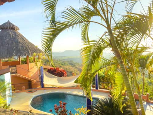
Cerrito Encantado is in the town of Altavista, minutes from the site turnoff, so you can be at the entrance in the good early light and back in the salt water pool by noon. Book direct and ask about the ride to the site.
See rentals